
XPW015330 NORTHERN IRELAND (1926). General View, Greenisland, Carrickfergus, Northern Ireland, 1926. Oblique aerial photograph taken facing North/West.

© Hawlfraint cyfranwyr OpenStreetMap a thrwyddedwyd gan yr OpenStreetMap Foundation. 2026. Trwyddedir y gartograffeg fel CC BY-SA.
Delweddau cyfagos (2)
XPW015330

XPW015329

Manylion
| Pennawd | [XPW015330] General View, Greenisland, Carrickfergus, Northern Ireland, 1926. Oblique aerial photograph taken facing North/West. |
| Cyfeirnod | XPW015330 |
| Dyddiad | 1926 |
| Dolen | |
| Enw lle | GREENISLAND |
| Plwyf | NORTHERN IRELAND |
| Ardal | |
| Gwlad | NORTHERN IRELAND |
| Dwyreiniad / Gogleddiad | 152284, 540790 |
| Hydred / Lledred | -5.84629, 54.701003 |
| Cyfeirnod Grid Cenedlaethol |
Pinnau
Cyfraniadau Grŵp
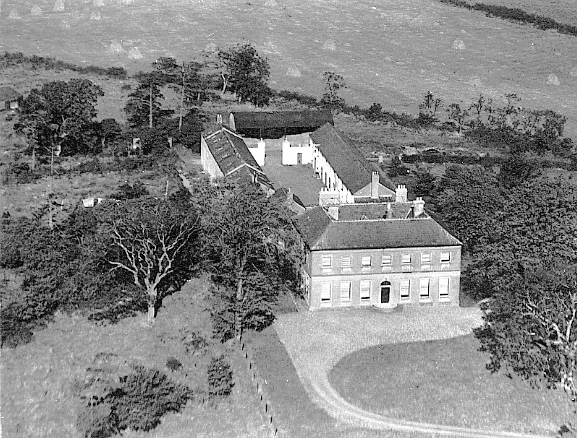
The house just visible in the top right corner was Scoutbush and was also owned by the Clarks, who owned Seapark the main house in the picture. Bizarrely, Scoutbush had greater historical importance but did not survive. I have uploaded another aerial photo showing more fully Scoutbush which, may have been taken by Aerofilms though unable to confirm. The vintage would be about right. Would be good to locate the original (or further aerial shots) as this is only a copy of a copy. |

Ian |
Wednesday 15th of October 2014 11:37:27 AM |

1926 |
Valerie |
Monday 13th of October 2014 11:14:52 PM |