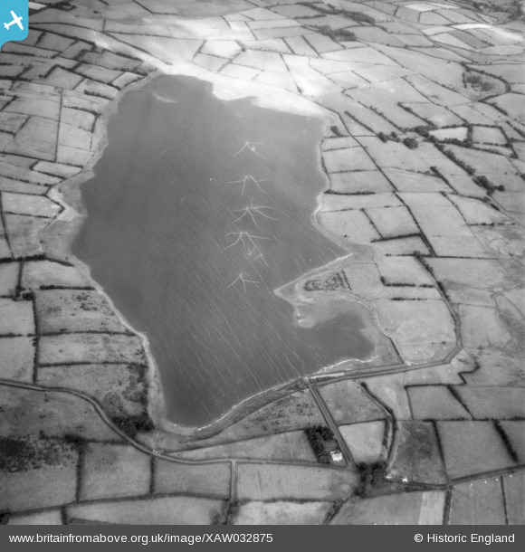
XAW032875 NORTHERN IRELAND (1950). Reservoir, Lough Mourne, Carrickfergus, Northern Ireland, 1950. Oblique aerial photograph taken facing North/West.
© Hawlfraint cyfranwyr OpenStreetMap a thrwyddedwyd gan yr OpenStreetMap Foundation. 2026. Trwyddedir y gartograffeg fel CC BY-SA.
Manylion
| Pennawd | [XAW032875] Reservoir, Lough Mourne, Carrickfergus, Northern Ireland, 1950. Oblique aerial photograph taken facing North/West. |
| Cyfeirnod | XAW032875 |
| Dyddiad | 20-September-1950 |
| Dolen | |
| Enw lle | LOUGH MOURNE |
| Plwyf | NORTHERN IRELAND |
| Ardal | |
| Gwlad | NORTHERN IRELAND |
| Dwyreiniad / Gogleddiad | 155233, 547504 |
| Hydred / Lledred | -5.806273, 54.762646 |
| Cyfeirnod Grid Cenedlaethol |
Pinnau
Byddwch y cyntaf i ychwanegu sylw at y ddelwedd hon!
Cyfraniadau Grŵp

Valerie |
Monday 13th of October 2014 11:10:06 PM |


![[XAW032875] Reservoir, Lough Mourne, Carrickfergus, Northern Ireland, 1950. Oblique aerial photograph taken facing North/West.](http://britainfromabove.org.uk/sites/all/libraries/aerofilms-images/public/100x100/XAW/032/XAW032875.jpg)
![[XAW032876] Reservoir, Lough Mourne, Carrickfergus, Northern Ireland, 1950. Oblique aerial photograph taken facing North/West.](http://britainfromabove.org.uk/sites/all/libraries/aerofilms-images/public/100x100/XAW/032/XAW032876.jpg)
