
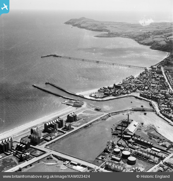
XAW023424 ISLE OF MAN (1949). General View, Ramsey, Isle of Man, Isle of Man, 1949. Oblique aerial photograph taken facing East.
© Hawlfraint cyfranwyr OpenStreetMap a thrwyddedwyd gan yr OpenStreetMap Foundation. 2026. Trwyddedir y gartograffeg fel CC BY-SA.
Delweddau cyfagos (2)
XAW023424

XAW023422

Manylion
| Pennawd | [XAW023424] General View, Ramsey, Isle of Man, Isle of Man, 1949. Oblique aerial photograph taken facing East. |
| Cyfeirnod | XAW023424 |
| Dyddiad | 26-May-1949 |
| Dolen | |
| Enw lle | RAMSEY |
| Plwyf | ISLE OF MAN |
| Ardal | |
| Gwlad | ISLE OF MAN |
| Dwyreiniad / Gogleddiad | 245595, 494385 |
| Hydred / Lledred | -4.37552, 54.321627 |
| Cyfeirnod Grid Cenedlaethol |
Pinnau

Oliver Mills |
Thursday 1st of June 2017 12:27:15 PM | |
|
Oliver Mills |
Thursday 1st of June 2017 12:22:22 PM | |
|
Arthur |
Thursday 17th of March 2016 09:49:42 PM | |
|
Arthur |
Wednesday 16th of March 2016 10:21:09 AM | |
|
Arthur |
Wednesday 16th of March 2016 10:20:04 AM | |
|
Arthur |
Wednesday 16th of March 2016 10:19:11 AM | |
|
John Wass |
Saturday 6th of February 2016 08:48:02 PM |