
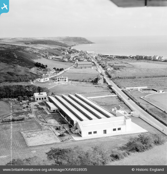
XAW018935 IRELAND (1948). The Midleton Worsted Mills, Midleton, Cork, Ireland, 1948. Oblique aerial photograph taken facing East. This image was marked by Aerofilms Ltd for photo editing.
© Hawlfraint cyfranwyr OpenStreetMap a thrwyddedwyd gan yr OpenStreetMap Foundation. 2026. Trwyddedir y gartograffeg fel CC BY-SA.
Delweddau cyfagos (7)
XAW018935

XAW018937

XAW018938

XAW018932

XAW018933

XAW018936

XAW018934

Manylion
| Pennawd | [XAW018935] The Midleton Worsted Mills, Midleton, Cork, Ireland, 1948. Oblique aerial photograph taken facing East. This image was marked by Aerofilms Ltd for photo editing. |
| Cyfeirnod | XAW018935 |
| Dyddiad | 24-September-1948 |
| Dolen | |
| Enw lle | MIDLETON |
| Plwyf | IRELAND |
| Ardal | |
| Gwlad | IRELAND |
| Dwyreiniad / Gogleddiad | -2318, 243169 |
| Hydred / Lledred | -7.856376, 51.941058 |
| Cyfeirnod Grid Cenedlaethol |
Pinnau

Iarnrod |
Monday 10th of July 2017 03:02:56 PM | |

powerpop |
Saturday 10th of October 2015 12:46:58 PM | |
|
powerpop |
Saturday 2nd of May 2015 05:48:05 PM | |
|
powerpop |
Monday 13th of October 2014 05:22:37 PM | |
|
powerpop |
Monday 13th of October 2014 05:22:18 PM | |
|
powerpop |
Monday 13th of October 2014 05:21:36 PM |