
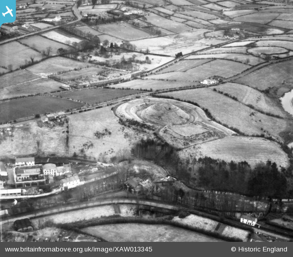
XAW013345 NORTHERN IRELAND (1948). General View, Belfast, Banbridge, Northern Ireland, 1948. Oblique aerial photograph taken facing North/East.
© Hawlfraint cyfranwyr OpenStreetMap a thrwyddedwyd gan yr OpenStreetMap Foundation. 2026. Trwyddedir y gartograffeg fel CC BY-SA.
Delweddau cyfagos (6)
XAW013345

XAW044912

XAW044911

XAW040579

XAW013344

XAW051884

Manylion
| Pennawd | [XAW013345] General View, Belfast, Banbridge, Northern Ireland, 1948. Oblique aerial photograph taken facing North/East. |
| Cyfeirnod | XAW013345 |
| Dyddiad | 15-February-1948 |
| Dolen | |
| Enw lle | BELFAST |
| Plwyf | NORTHERN IRELAND |
| Ardal | |
| Gwlad | NORTHERN IRELAND |
| Dwyreiniad / Gogleddiad | 131217, 509837 |
| Hydred / Lledred | -6.144071, 54.412766 |
| Cyfeirnod Grid Cenedlaethol |
Pinnau

TonyMc |
Friday 31st of October 2014 11:44:45 AM | |
|
TonyMc |
Friday 31st of October 2014 11:39:44 AM | |
|
TonyMc |
Friday 31st of October 2014 11:37:57 AM | |
|
TonyMc |
Friday 31st of October 2014 11:37:09 AM |