
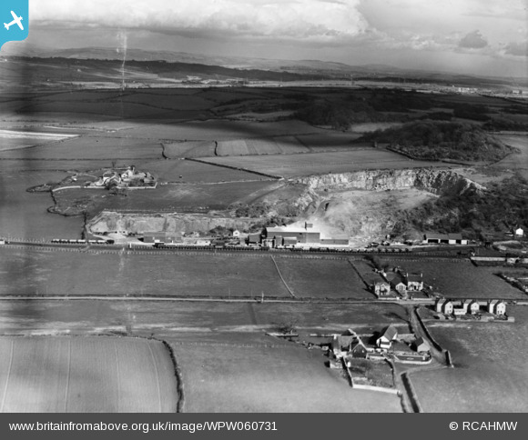
WPW060731 WALES (1939). View of C.F. Gaen, Cornelly Quarries, Pyle, oblique aerial view. 5"x4" black and white glass plate negative.
© Hawlfraint cyfranwyr OpenStreetMap a thrwyddedwyd gan yr OpenStreetMap Foundation. 2026. Trwyddedir y gartograffeg fel CC BY-SA.
Delweddau cyfagos (7)
WPW060726

WPW060727

WPW060728

WPW060729

WPW060730

WPW060731

WPW060732

Manylion
| Pennawd | [WPW060731] View of C.F. Gaen, Cornelly Quarries, Pyle, oblique aerial view. 5"x4" black and white glass plate negative. |
| Cyfeirnod | WPW060731 |
| Dyddiad | 1939 |
| Dolen | Coflein Archive Item 6370491 |
| Enw lle | |
| Plwyf | |
| Ardal | |
| Gwlad | WALES |
| Dwyreiniad / Gogleddiad | 282161, 180552 |
| Hydred / Lledred | -3.6982883339402, 51.511108778223 |
| Cyfeirnod Grid Cenedlaethol | SS822806 |
Pinnau

Harvey |
Monday 30th of March 2015 10:21:24 PM | |
|
Colin Ball |
Sunday 28th of October 2012 05:11:40 PM | |
|
Colin Ball |
Sunday 28th of October 2012 04:51:05 PM |