
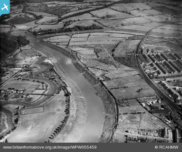
WPW055459 WALES (1937). View of Shaftesbury area of Newport showing river, park, allotments and sports ground, oblique aerial view. 5"x4" black and white glass plate negative.
© Hawlfraint cyfranwyr OpenStreetMap a thrwyddedwyd gan yr OpenStreetMap Foundation. 2026. Trwyddedir y gartograffeg fel CC BY-SA.
Delweddau cyfagos (4)
WPW055456

WPW055457

WPW055458

WPW055459

Manylion
| Pennawd | [WPW055459] View of Shaftesbury area of Newport showing river, park, allotments and sports ground, oblique aerial view. 5"x4" black and white glass plate negative. |
| Cyfeirnod | WPW055459 |
| Dyddiad | 15-September-1937 |
| Dolen | Coflein Archive Item 6370131 |
| Enw lle | |
| Plwyf | |
| Ardal | |
| Gwlad | WALES |
| Dwyreiniad / Gogleddiad | 331383, 189134 |
| Hydred / Lledred | -2.9907336562406, 51.596394975746 |
| Cyfeirnod Grid Cenedlaethol | ST314891 |
Pinnau
Byddwch y cyntaf i ychwanegu sylw at y ddelwedd hon!