
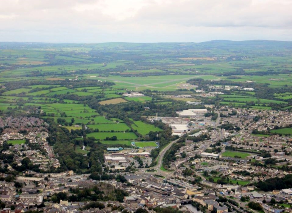
WPW040056 WALES (1932). General view of Haverfordwest, showing hospital, oblique aerial view. 5"x4" black and white glass plate negative.

© Hawlfraint cyfranwyr OpenStreetMap a thrwyddedwyd gan yr OpenStreetMap Foundation. 2026. Trwyddedir y gartograffeg fel CC BY-SA.
Delweddau cyfagos (8)
WAW033606

WAW033607

WAW033608

WAW033609

WPW040055

WPW040056

WPW040057

WPW040058

Manylion
| Pennawd | [WPW040056] General view of Haverfordwest, showing hospital, oblique aerial view. 5"x4" black and white glass plate negative. |
| Cyfeirnod | WPW040056 |
| Dyddiad | 1932 |
| Dolen | Coflein Archive Item 6369669 |
| Enw lle | |
| Plwyf | |
| Ardal | |
| Gwlad | WALES |
| Dwyreiniad / Gogleddiad | 195309, 215672 |
| Hydred / Lledred | -4.9691362452415, 51.801716134402 |
| Cyfeirnod Grid Cenedlaethol | SM953157 |
Pinnau

Dylan Moore |
Wednesday 31st of October 2012 09:59:56 PM | |

Gonk |
Friday 3rd of August 2012 08:59:59 PM | |
|
DeborahWales |
Saturday 30th of June 2012 07:18:33 PM | |
|
DeborahWales |
Saturday 30th of June 2012 07:10:11 PM | |
|
DeborahWales |
Saturday 30th of June 2012 06:03:26 PM | |
|
DeborahWales |
Saturday 30th of June 2012 06:02:17 PM |
Cyfraniadau Grŵp
Aerial view of Haverfordwest October 2013 courtesy Con Shields |

Class31 |
Sunday 6th of April 2014 05:40:11 PM |

St Thomas', Haverfordwest |
DeborahWales |
Saturday 30th of June 2012 06:01:28 PM |