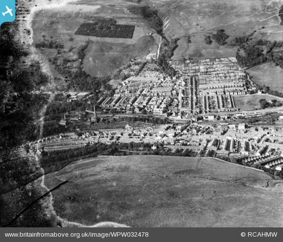
WPW032478 WALES (1930). General view of Mountain Ash, oblique aerial view. 5"x4" black and white glass plate negative.
© Hawlfraint cyfranwyr OpenStreetMap a thrwyddedwyd gan yr OpenStreetMap Foundation. 2026. Trwyddedir y gartograffeg fel CC BY-SA.
Delweddau cyfagos (6)
WPW032477

WPW032478

WPW032479

WPW040010

WPW040011

WPW040012

Manylion
| Pennawd | [WPW032478] General view of Mountain Ash, oblique aerial view. 5"x4" black and white glass plate negative. |
| Cyfeirnod | WPW032478 |
| Dyddiad | 1930 |
| Dolen | Coflein Archive Item 6370790 |
| Enw lle | |
| Plwyf | |
| Ardal | |
| Gwlad | WALES |
| Dwyreiniad / Gogleddiad | 304710, 199270 |
| Hydred / Lledred | -3.3785121109573, 51.683633193742 |
| Cyfeirnod Grid Cenedlaethol | ST047993 |