
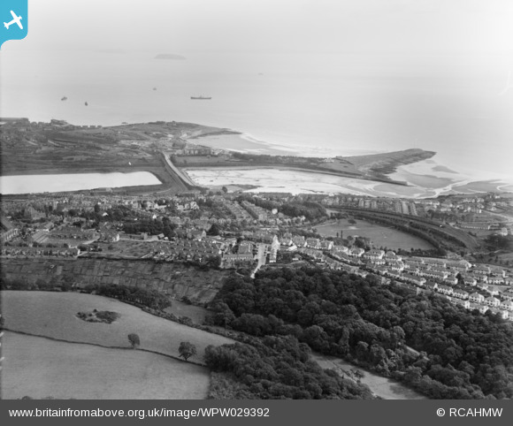
WPW029392 WALES (1929). View of Barry showing Romilly Park, oblique aerial view. 5"x4" black and white glass plate negative.
© Hawlfraint cyfranwyr OpenStreetMap a thrwyddedwyd gan yr OpenStreetMap Foundation. 2026. Trwyddedir y gartograffeg fel CC BY-SA.
Delweddau cyfagos (15)
WPW006090

WPW006093

WPW006094

WPW006096

WPW008635

WPW024955A

WPW029392

WPW029399

WPW029400

WPW029456

WPW029458

WPW029459

WPW029461

WPW029462

WPW041252

Manylion
| Pennawd | [WPW029392] View of Barry showing Romilly Park, oblique aerial view. 5"x4" black and white glass plate negative. |
| Cyfeirnod | WPW029392 |
| Dyddiad | 1929 |
| Dolen | Coflein Archive Item 6378051 |
| Enw lle | |
| Plwyf | |
| Ardal | |
| Gwlad | WALES |
| Dwyreiniad / Gogleddiad | 311000, 166000 |
| Hydred / Lledred | -3.2791309458519, 51.385561791936 |
| Cyfeirnod Grid Cenedlaethol | ST110660 |
Pinnau

Louis |
Sunday 2nd of March 2014 01:17:08 PM |
Cyfraniadau Grŵp
Romilly Park - Centre right! Fields at bottom left are part of Cwm Ciddy Farm. Allotments behind Oxford Street and Salisbury Road above then woods which lead down into Porthkerry Park. Above woods the newly built Garden Suburb. |
aderyngoch |
Tuesday 26th of June 2012 01:10:55 PM |