
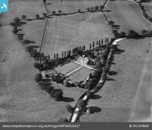
WPW019417 WALES (1927). View of Frondeg Hall, oblique aerial view. 5"x4" black and white glass plate negative.
© Hawlfraint cyfranwyr OpenStreetMap a thrwyddedwyd gan yr OpenStreetMap Foundation. 2026. Trwyddedir y gartograffeg fel CC BY-SA.
Delweddau cyfagos (2)
WPW019417

WPW019419

Manylion
| Pennawd | [WPW019417] View of Frondeg Hall, oblique aerial view. 5"x4" black and white glass plate negative. |
| Cyfeirnod | WPW019417 |
| Dyddiad | 1927 |
| Dolen | Coflein Archive Item 6378313 |
| Enw lle | |
| Plwyf | |
| Ardal | |
| Gwlad | WALES |
| Dwyreiniad / Gogleddiad | 328770, 348550 |
| Hydred / Lledred | -3.0622212277618, 53.029183181211 |
| Cyfeirnod Grid Cenedlaethol | SJ288486 |
Pinnau
Cyfraniadau Grŵp

Identified as Frondeg Hall, Wrexham. Added for interest only. |
Matthew Beckett - The Country Seat |
Thursday 13th of September 2012 09:34:41 PM |
This is a positive identification of Frondeg Hall about two miles West of Rhostyllen, Wrexham. Hall is adjacent to Bronwylfa Road B5426 and the road orientates correctly. The shape of the garden paths is right. shot is taken looking West. Map reference SJ 28749 48572 |

Class31 |
Tuesday 17th of July 2012 10:38:34 AM |