
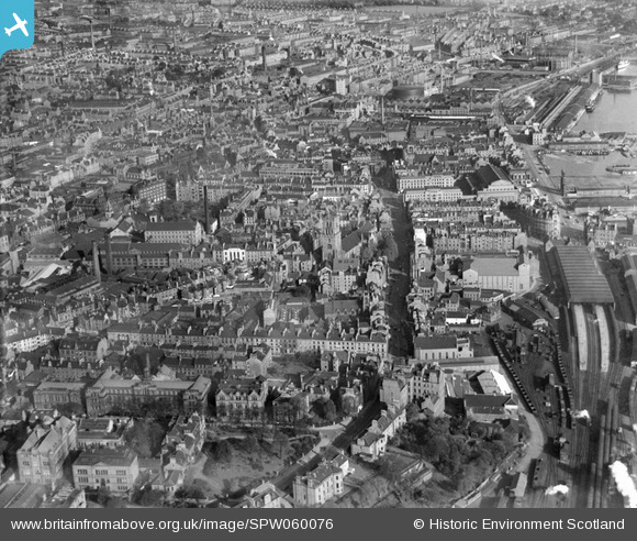
SPW060076 SCOTLAND (1938). Dundee, general view, showing Steeple Church, Nethergate and East Dock Street. An oblique aerial photograph taken facing north-east.
© Hawlfraint cyfranwyr OpenStreetMap a thrwyddedwyd gan yr OpenStreetMap Foundation. 2026. Trwyddedir y gartograffeg fel CC BY-SA.
Delweddau cyfagos (15)
SPW060076

SPW060073

SPW060075

SAW019554

SPW060072

SPW060074

SAR017651

SAR017652

SAR017653

SPW019925

SAW009822

SAW014833

SAW014835

SAW051265

SPW019930

Manylion
| Pennawd | [SPW060076] Dundee, general view, showing Steeple Church, Nethergate and East Dock Street. An oblique aerial photograph taken facing north-east. |
| Cyfeirnod | SPW060076 |
| Dyddiad | 1938 |
| Dolen | NRHE Collection item 1259538 |
| Enw lle | |
| Plwyf | DUNDEE (DUNDEE, CITY OF) |
| Ardal | CITY OF DUNDEE |
| Gwlad | SCOTLAND |
| Dwyreiniad / Gogleddiad | 340136, 730121 |
| Hydred / Lledred | -2.9715243182049, 56.459532726018 |
| Cyfeirnod Grid Cenedlaethol | NO401301 |

