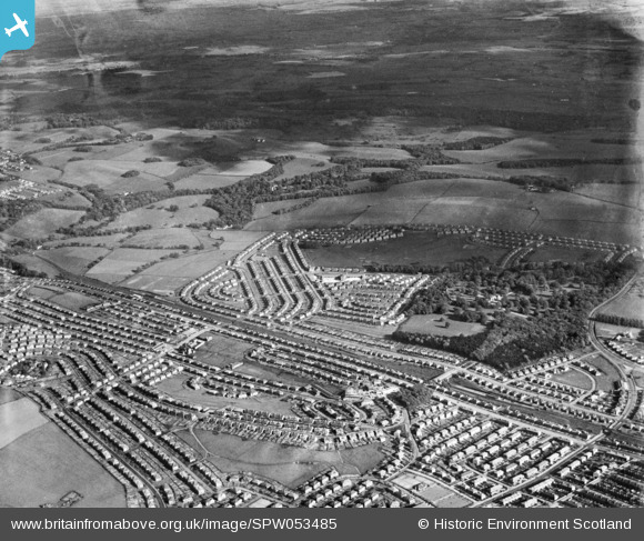
SPW053485 SCOTLAND (1937). General view, Bankhead, Cathcart, Lanarkshire, Scotland, 1937. An oblique aerial photograph, taken facing south.
    © Hawlfraint cyfranwyr OpenStreetMap a thrwyddedwyd gan yr OpenStreetMap Foundation. 2025. Trwyddedir y gartograffeg fel CC BY-SA.
  
Manylion
| Pennawd | [SPW053485] General view, Bankhead, Cathcart, Lanarkshire, Scotland, 1937. An oblique aerial photograph, taken facing south. | 
| Cyfeirnod | SPW053485 | 
| Dyddiad | 1937 | 
| Dolen | NRHE Collection item 1452119 | 
| Enw lle | |
| Plwyf | GLASGOW (CITY OF GLASGOW) | 
| Ardal | CITY OF GLASGOW | 
| Gwlad | SCOTLAND | 
| Dwyreiniad / Gogleddiad | 260000, 660000 | 
| Hydred / Lledred | -4.234395542766, 55.812963550358 | 
| Cyfeirnod Grid Cenedlaethol | NS600600 | 
Pinnau
Byddwch y cyntaf i ychwanegu sylw at y ddelwedd hon!
 
             
  ![[SPW053485] General view, Bankhead, Cathcart, Lanarkshire, Scotland, 1937. An oblique aerial photograph, taken facing south.](http://britainfromabove.org.uk/sites/all/libraries/aerofilms-images/public/100x100/SPW/053/SPW053485.jpg) 
  
                                          ![[SPW053486] General view, Bankhead, Cathcart, Lanarkshire, Scotland, 1937. An oblique aerial photograph, taken facing south.](http://britainfromabove.org.uk/sites/all/libraries/aerofilms-images/public/100x100/SPW/053/SPW053486.jpg) 
 ![[SPW035651] King's Park and Croftfoot Housing Estates, Glasgow.  An oblique aerial photograph taken facing north.](http://britainfromabove.org.uk/sites/all/libraries/aerofilms-images/public/100x100/SPW/035/SPW035651.jpg) 
 ![[SPW035652] King's Park and Croftfoot Housing Estates, Glasgow.  An oblique aerial photograph taken facing north.](http://britainfromabove.org.uk/sites/all/libraries/aerofilms-images/public/100x100/SPW/035/SPW035652.jpg)