
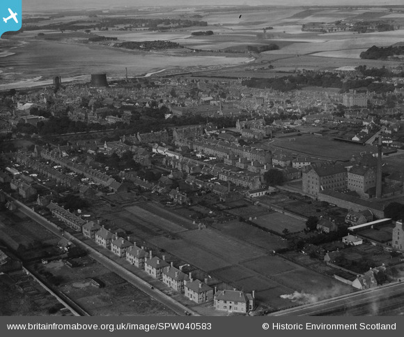
SPW040583 SCOTLAND (1932). Montrose, general view, showing Links Park Football Ground and Christie's Lane. An oblique aerial photograph taken facing north-west. This image has been produced from a print.
© Hawlfraint cyfranwyr OpenStreetMap a thrwyddedwyd gan yr OpenStreetMap Foundation. 2026. Trwyddedir y gartograffeg fel CC BY-SA.
Delweddau cyfagos (2)
SPW040583

SPW033641

Manylion
| Pennawd | [SPW040583] Montrose, general view, showing Links Park Football Ground and Christie's Lane. An oblique aerial photograph taken facing north-west. This image has been produced from a print. |
| Cyfeirnod | SPW040583 |
| Dyddiad | 1932 |
| Dolen | NRHE Collection item 1315569 |
| Enw lle | |
| Plwyf | MONTROSE |
| Ardal | ANGUS |
| Gwlad | SCOTLAND |
| Dwyreiniad / Gogleddiad | 371924, 757977 |
| Hydred / Lledred | -2.4586914175382, 56.712772871092 |
| Cyfeirnod Grid Cenedlaethol | NO719580 |
Pinnau
Byddwch y cyntaf i ychwanegu sylw at y ddelwedd hon!
Cyfraniadau Grŵp

Links Park the home of Montrose since 1887. |

Paulie |
Tuesday 7th of May 2013 01:13:21 AM |