
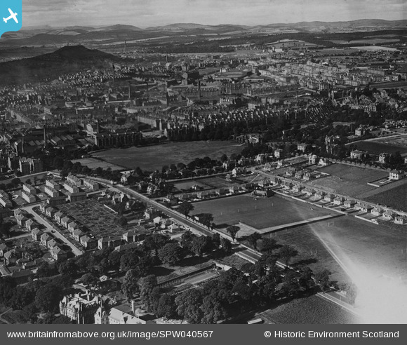
SPW040567 SCOTLAND (1932). Dundee, general view, showing Arbroath Road and Baxter Park. An oblique aerial photograph taken facing west. This image has been produced from a print.
© Hawlfraint cyfranwyr OpenStreetMap a thrwyddedwyd gan yr OpenStreetMap Foundation. 2026. Trwyddedir y gartograffeg fel CC BY-SA.
Delweddau cyfagos (2)
SPW040567

SAW010735

Manylion
| Pennawd | [SPW040567] Dundee, general view, showing Arbroath Road and Baxter Park. An oblique aerial photograph taken facing west. This image has been produced from a print. |
| Cyfeirnod | SPW040567 |
| Dyddiad | 1932 |
| Dolen | NRHE Collection item 1315558 |
| Enw lle | |
| Plwyf | DUNDEE (DUNDEE, CITY OF) |
| Ardal | CITY OF DUNDEE |
| Gwlad | SCOTLAND |
| Dwyreiniad / Gogleddiad | 341523, 731521 |
| Hydred / Lledred | -2.9493322014268, 56.472284176706 |
| Cyfeirnod Grid Cenedlaethol | NO415315 |
Pinnau

Grant Buttars |
Monday 12th of August 2024 08:12:36 AM | |
|
Grant Buttars |
Monday 12th of August 2024 08:11:32 AM | |
|
Grant Buttars |
Monday 12th of August 2024 08:10:34 AM | |
|
Grant Buttars |
Wednesday 9th of December 2020 05:38:52 PM | |
|
Grant Buttars |
Wednesday 9th of December 2020 03:31:12 PM | |
|
robw0910 |
Monday 29th of September 2014 02:21:55 AM | |

Finchleyflyer |
Friday 15th of August 2014 12:20:10 PM |