
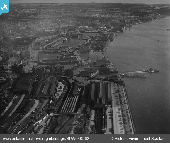
SPW040562 SCOTLAND (1932). Dundee, general view, showing Dundee Docks and Tay Bridge Station. An oblique aerial photograph taken facing north-east. This image has been produced from a print.
© Hawlfraint cyfranwyr OpenStreetMap a thrwyddedwyd gan yr OpenStreetMap Foundation. 2026. Trwyddedir y gartograffeg fel CC BY-SA.
Delweddau cyfagos (8)
SPW040562

SPW019937

SPW019939

SPW022110

SPW040561

SPW042547

SPW019925

SPW022103

Manylion
| Pennawd | [SPW040562] Dundee, general view, showing Dundee Docks and Tay Bridge Station. An oblique aerial photograph taken facing north-east. This image has been produced from a print. |
| Cyfeirnod | SPW040562 |
| Dyddiad | 1932 |
| Dolen | NRHE Collection item 1315553 |
| Enw lle | |
| Plwyf | DUNDEE (DUNDEE, CITY OF) |
| Ardal | CITY OF DUNDEE |
| Gwlad | SCOTLAND |
| Dwyreiniad / Gogleddiad | 340510, 729920 |
| Hydred / Lledred | -2.9654098941835, 56.457774323868 |
| Cyfeirnod Grid Cenedlaethol | NO405299 |
Pinnau
Byddwch y cyntaf i ychwanegu sylw at y ddelwedd hon!