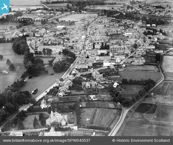
SPW040537 SCOTLAND (1932). Forres, general view, showing High Street and Forres Academy. An oblique aerial photograph taken facing south-west.
© Hawlfraint cyfranwyr OpenStreetMap a thrwyddedwyd gan yr OpenStreetMap Foundation. 2026. Trwyddedir y gartograffeg fel CC BY-SA.
Delweddau cyfagos (6)
Manylion
| Pennawd | [SPW040537] Forres, general view, showing High Street and Forres Academy. An oblique aerial photograph taken facing south-west. |
| Cyfeirnod | SPW040537 |
| Dyddiad | 1932 |
| Dolen | NRHE Collection item 1257558 |
| Enw lle | |
| Plwyf | FORRES |
| Ardal | MORAY |
| Gwlad | SCOTLAND |
| Dwyreiniad / Gogleddiad | 303951, 859120 |
| Hydred / Lledred | -3.6078389346095, 57.612066880804 |
| Cyfeirnod Grid Cenedlaethol | NJ040591 |
Pinnau
Byddwch y cyntaf i ychwanegu sylw at y ddelwedd hon!


![[SPW040537] Forres, general view, showing High Street and Forres Academy. An oblique aerial photograph taken facing south-west.](http://britainfromabove.org.uk/sites/all/libraries/aerofilms-images/public/100x100/SPW/040/SPW040537.jpg)
![[SPW022125] Forres, general view, showing High Street and Forres Academy. An oblique aerial photograph taken facing south-west.](http://britainfromabove.org.uk/sites/all/libraries/aerofilms-images/public/100x100/SPW/022/SPW022125.jpg)
![[SPW022122] Forres, general view, showing Town Hall and St Leonard's Church, High Street. An oblique aerial photograph taken facing south-east.](http://britainfromabove.org.uk/sites/all/libraries/aerofilms-images/public/100x100/SPW/022/SPW022122.jpg)
![[SAR023955] General View Forres, Morayshire, Scotland. An oblique aerial photograph taken facing North/East.](http://britainfromabove.org.uk/sites/all/libraries/aerofilms-images/public/100x100/SAR/023/SAR023955.jpg)
![[SAR023956] General View Forres, Morayshire, Scotland. An oblique aerial photograph taken facing North/East. This image was marked by AeroPictorial Ltd for photo editing.](http://britainfromabove.org.uk/sites/all/libraries/aerofilms-images/public/100x100/SAR/023/SAR023956.jpg)
![[SAR033422] General View Forres, Morayshire, Scotland. An oblique aerial photograph taken facing North/East.](http://britainfromabove.org.uk/sites/all/libraries/aerofilms-images/public/100x100/SAR/033/SAR033422.jpg)