
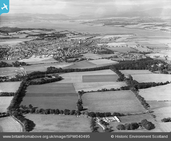
SPW040495 SCOTLAND (1932). Inverness, general view, showing Cameron Barracks and Beauly Firth. An oblique aerial photograph taken facing north-west.
© Hawlfraint cyfranwyr OpenStreetMap a thrwyddedwyd gan yr OpenStreetMap Foundation. 2026. Trwyddedir y gartograffeg fel CC BY-SA.
Delweddau cyfagos (2)
SPW040495

SAW019867

Manylion
| Pennawd | [SPW040495] Inverness, general view, showing Cameron Barracks and Beauly Firth. An oblique aerial photograph taken facing north-west. |
| Cyfeirnod | SPW040495 |
| Dyddiad | 1932 |
| Dolen | NRHE Collection item 1257531 |
| Enw lle | |
| Plwyf | INVERNESS AND BONA |
| Ardal | INVERNESS |
| Gwlad | SCOTLAND |
| Dwyreiniad / Gogleddiad | 268165, 844999 |
| Hydred / Lledred | -4.1988000846048, 57.476270165126 |
| Cyfeirnod Grid Cenedlaethol | NH682450 |
Pinnau

JMB |
Thursday 28th of April 2016 05:55:18 PM | |
|
JMB |
Thursday 28th of April 2016 05:51:19 PM | |
|
JMB |
Thursday 28th of April 2016 05:50:14 PM | |
|
JMB |
Thursday 28th of April 2016 05:46:38 PM | |
|
JMB |
Thursday 28th of April 2016 05:45:21 PM |