
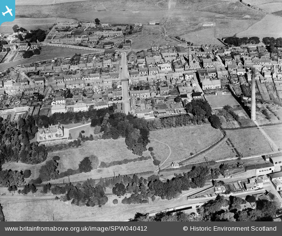
SPW040412 SCOTLAND (1932). Leslie, general view, showing High Street and Fettykil House. An oblique aerial photograph taken facing north.
© Hawlfraint cyfranwyr OpenStreetMap a thrwyddedwyd gan yr OpenStreetMap Foundation. 2026. Trwyddedir y gartograffeg fel CC BY-SA.
Delweddau cyfagos (5)
SPW040412

SPW042172

SPW042175

SPW042176

SPW040413

Manylion
| Pennawd | [SPW040412] Leslie, general view, showing High Street and Fettykil House. An oblique aerial photograph taken facing north. |
| Cyfeirnod | SPW040412 |
| Dyddiad | 1932 |
| Dolen | NRHE Collection item 1257484 |
| Enw lle | |
| Plwyf | LESLIE (KIRKCALDY) |
| Ardal | KIRKCALDY |
| Gwlad | SCOTLAND |
| Dwyreiniad / Gogleddiad | 325011, 701609 |
| Hydred / Lledred | -3.2088062346032, 56.20123912716 |
| Cyfeirnod Grid Cenedlaethol | NO250016 |
Pinnau
Byddwch y cyntaf i ychwanegu sylw at y ddelwedd hon!