
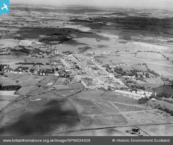
SPW034429 SCOTLAND (1930). Castle Douglas, general view, showing Cotton Street and Queen Street. An oblique aerial photograph taken facing east.
© Hawlfraint cyfranwyr OpenStreetMap a thrwyddedwyd gan yr OpenStreetMap Foundation. 2026. Trwyddedir y gartograffeg fel CC BY-SA.
Delweddau cyfagos (6)
SPW034429

SPW034430

SPW034434

SPW034431

SPW034432

SPW034436

Manylion
| Pennawd | [SPW034429] Castle Douglas, general view, showing Cotton Street and Queen Street. An oblique aerial photograph taken facing east. |
| Cyfeirnod | SPW034429 |
| Dyddiad | 1930 |
| Dolen | NRHE Collection item 1257157 |
| Enw lle | |
| Plwyf | KELTON |
| Ardal | STEWARTRY |
| Gwlad | SCOTLAND |
| Dwyreiniad / Gogleddiad | 276447, 562320 |
| Hydred / Lledred | -3.9289054530836, 54.940142415173 |
| Cyfeirnod Grid Cenedlaethol | NX764623 |
Pinnau

rawby93 |
Wednesday 13th of November 2024 10:17:17 AM | |
|
Ian Black |
Monday 12th of November 2012 10:44:54 PM | |
Yes, the TAS (builders' merchants)building is the old Castle Douglas railway goods shed. A line of rails ran into the building along the back so that railway trucks could be unloaded in the dry. |
Alistair Livingston |
Monday 4th of March 2013 02:58:43 PM |