
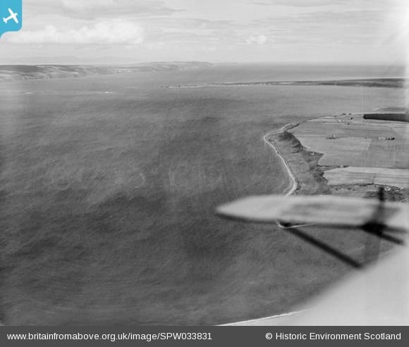
SPW033831 SCOTLAND (1930). Moray Firth, general view, showing Fisherton coastline to Fort George. An oblique aerial photograph taken facing north.
© Hawlfraint cyfranwyr OpenStreetMap a thrwyddedwyd gan yr OpenStreetMap Foundation. 2026. Trwyddedir y gartograffeg fel CC BY-SA.
Manylion
| Pennawd | [SPW033831] Moray Firth, general view, showing Fisherton coastline to Fort George. An oblique aerial photograph taken facing north. |
| Cyfeirnod | SPW033831 |
| Dyddiad | 1930 |
| Dolen | NRHE Collection item 1257063 |
| Enw lle | |
| Plwyf | PETTY |
| Ardal | INVERNESS |
| Gwlad | SCOTLAND |
| Dwyreiniad / Gogleddiad | 274390, 850740 |
| Hydred / Lledred | -4.0980143826929, 57.529576775847 |
| Cyfeirnod Grid Cenedlaethol | NH744507 |
Pinnau
Byddwch y cyntaf i ychwanegu sylw at y ddelwedd hon!
Cyfraniadau Grŵp

Coastlines are dynamic features, changing over time as sea levels rise and fall, and as coastal erosion carries away material from the land. This can be seen clearly in this images, as the sharp edge of the higher land gives way to the eroding slope of the coastline leading down to the sea. |

AlMu |
Wednesday 7th of May 2014 10:26:49 AM |