
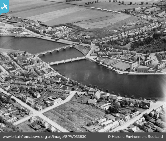
SPW033830 SCOTLAND (1930). Inverness, general view, showing Waterloo Bridge and Ness Viaduct. An oblique aerial photograph taken facing east.
© Hawlfraint cyfranwyr OpenStreetMap a thrwyddedwyd gan yr OpenStreetMap Foundation. 2026. Trwyddedir y gartograffeg fel CC BY-SA.
Delweddau cyfagos (2)
SPW033830

SAW019892

Manylion
| Pennawd | [SPW033830] Inverness, general view, showing Waterloo Bridge and Ness Viaduct. An oblique aerial photograph taken facing east. |
| Cyfeirnod | SPW033830 |
| Dyddiad | 1930 |
| Dolen | NRHE Collection item 1257062 |
| Enw lle | |
| Plwyf | INVERNESS AND BONA |
| Ardal | INVERNESS |
| Gwlad | SCOTLAND |
| Dwyreiniad / Gogleddiad | 266256, 845928 |
| Hydred / Lledred | -4.2311204260412, 57.484050809024 |
| Cyfeirnod Grid Cenedlaethol | NH663459 |
Pinnau
Byddwch y cyntaf i ychwanegu sylw at y ddelwedd hon!