
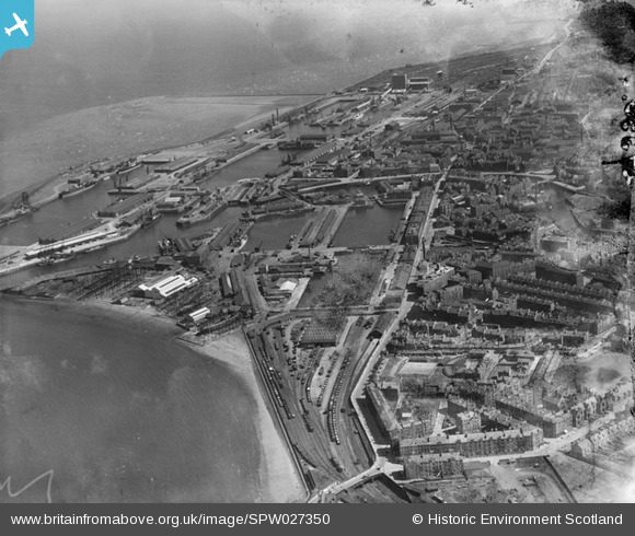
SPW027350 SCOTLAND (1929). Leith Docks, Edinburgh. An oblique aerial photograph taken facing east. This image has been produced from a damaged negative.
© Hawlfraint cyfranwyr OpenStreetMap a thrwyddedwyd gan yr OpenStreetMap Foundation. 2026. Trwyddedir y gartograffeg fel CC BY-SA.
Delweddau cyfagos (5)
SPW027350

SPW027121

SPW027122

SPW027118

SPW049101

Manylion
| Pennawd | [SPW027350] Leith Docks, Edinburgh. An oblique aerial photograph taken facing east. This image has been produced from a damaged negative. |
| Cyfeirnod | SPW027350 |
| Dyddiad | 1929 |
| Dolen | NRHE Collection item 1256856 |
| Enw lle | |
| Plwyf | EDINBURGH (EDINBURGH, CITY OF) |
| Ardal | CITY OF EDINBURGH |
| Gwlad | SCOTLAND |
| Dwyreiniad / Gogleddiad | 326860, 676780 |
| Hydred / Lledred | -3.1722128581252, 55.97846992675 |
| Cyfeirnod Grid Cenedlaethol | NT269768 |
Pinnau

camphill |
Friday 8th of November 2013 08:29:28 PM | |
|
camphill |
Friday 8th of November 2013 08:28:25 PM | |
|
vikkispence |
Tuesday 25th of June 2013 12:49:07 AM | |
|
vikkispence |
Tuesday 25th of June 2013 12:48:20 AM |