
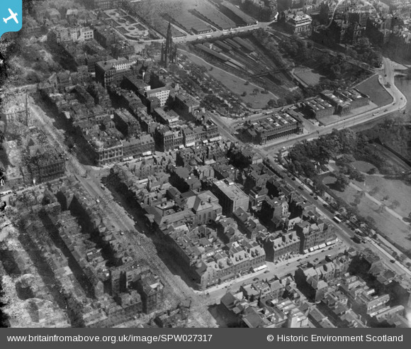
SPW027317 SCOTLAND (1929). Edinburgh, general view, showing George Street, The Mound and Princes Street Gardens. An oblique aerial photograph taken facing east. This image has been produced from a damaged negative.
© Hawlfraint cyfranwyr OpenStreetMap a thrwyddedwyd gan yr OpenStreetMap Foundation. 2026. Trwyddedir y gartograffeg fel CC BY-SA.
Delweddau cyfagos (31)
SPW027317

SPW027343

SAR008700

SAR008701

SAR021179

SAR021181

SAR021202

SAR022326

SAR029124

SAR029125

SAR029126

SAR033371

SAR033377

SPW056031

SPW056032

SPW027325

SAR010381

SAR010388

SPW056027

SPW056028

SPW056029

SPW056030

SAW010250

SPW027133

SPW040193

SPW027132

SAW009821

SAW010251

SAW010253

SAW010260

SPW027327

Manylion
| Pennawd | [SPW027317] Edinburgh, general view, showing George Street, The Mound and Princes Street Gardens. An oblique aerial photograph taken facing east. This image has been produced from a damaged negative. |
| Cyfeirnod | SPW027317 |
| Dyddiad | 1929 |
| Dolen | NRHE Collection item 1256853 |
| Enw lle | |
| Plwyf | EDINBURGH (EDINBURGH, CITY OF) |
| Ardal | CITY OF EDINBURGH |
| Gwlad | SCOTLAND |
| Dwyreiniad / Gogleddiad | 325348, 673908 |
| Hydred / Lledred | -3.1956438436947, 55.952435591209 |
| Cyfeirnod Grid Cenedlaethol | NT253739 |
Pinnau
Byddwch y cyntaf i ychwanegu sylw at y ddelwedd hon!