
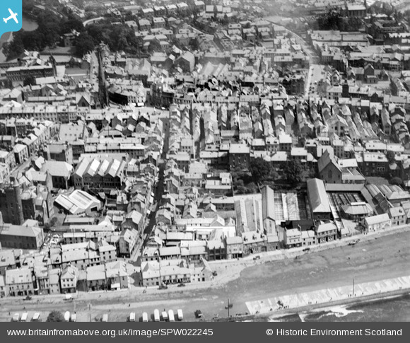
SPW022245 SCOTLAND (1928). Dumfries, general view, showing Friars Vennel and White Sands. An oblique aerial photograph taken facing north-east.
© Hawlfraint cyfranwyr OpenStreetMap a thrwyddedwyd gan yr OpenStreetMap Foundation. 2026. Trwyddedir y gartograffeg fel CC BY-SA.
Delweddau cyfagos (6)
SPW022245

SAR019969

SAR018995

SPW022240

SPW022241

SPW022243

Manylion
| Pennawd | [SPW022245] Dumfries, general view, showing Friars Vennel and White Sands. An oblique aerial photograph taken facing north-east. |
| Cyfeirnod | SPW022245 |
| Dyddiad | 1928 |
| Dolen | NRHE Collection item 1256559 |
| Enw lle | |
| Plwyf | DUMFRIES |
| Ardal | NITHSDALE |
| Gwlad | SCOTLAND |
| Dwyreiniad / Gogleddiad | 297085, 576149 |
| Hydred / Lledred | -3.6118361638776, 55.069061495733 |
| Cyfeirnod Grid Cenedlaethol | NX971761 |
