
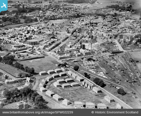
SPW022239 SCOTLAND (1928). Dumfries, general view, showing Brooms Road and Queen Street. An oblique aerial photograph taken facing west.
© Hawlfraint cyfranwyr OpenStreetMap a thrwyddedwyd gan yr OpenStreetMap Foundation. 2026. Trwyddedir y gartograffeg fel CC BY-SA.
Delweddau cyfagos (2)
SPW022239

SPW022248

Manylion
| Pennawd | [SPW022239] Dumfries, general view, showing Brooms Road and Queen Street. An oblique aerial photograph taken facing west. |
| Cyfeirnod | SPW022239 |
| Dyddiad | 1928 |
| Dolen | NRHE Collection item 1256553 |
| Enw lle | |
| Plwyf | DUMFRIES |
| Ardal | NITHSDALE |
| Gwlad | SCOTLAND |
| Dwyreiniad / Gogleddiad | 297687, 575927 |
| Hydred / Lledred | -3.6023321692861, 55.067191535476 |
| Cyfeirnod Grid Cenedlaethol | NX977759 |
Pinnau

Krissy |
Thursday 11th of December 2025 11:58:25 AM | |
|
MB |
Wednesday 3rd of February 2021 03:58:23 PM | |
|
MB |
Wednesday 3rd of February 2021 03:57:25 PM | |
|
Vonnegut |
Friday 31st of July 2015 10:42:56 PM | |
|
chiswick_doonhamer |
Monday 4th of November 2013 02:22:18 PM | |
|
chiswick_doonhamer |
Thursday 27th of December 2012 02:15:15 PM | |
|
Scales |
Wednesday 27th of June 2012 07:15:42 PM | |
|
McBrucie |
Tuesday 26th of June 2012 11:37:33 PM | |
Thanks for marking the power station I've added this picture to the Power Stations Scottish group |
cell |
Sunday 22nd of July 2012 03:30:03 PM |

Cyfraniadau Grŵp

Dumfries Leafield Rd Power Station |
cell |
Sunday 22nd of July 2012 03:28:17 PM |