
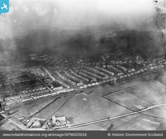
SPW020618 SCOTLAND (1928). Kings Park Housing Estate, Glasgow. An oblique aerial photograph taken facing north-east. This image has been produced from a damaged negative.
© Hawlfraint cyfranwyr OpenStreetMap a thrwyddedwyd gan yr OpenStreetMap Foundation. 2026. Trwyddedir y gartograffeg fel CC BY-SA.
Delweddau cyfagos (4)
SPW020617

SPW020618

SPW022168

SPW020614

Manylion
| Pennawd | [SPW020618] Kings Park Housing Estate, Glasgow. An oblique aerial photograph taken facing north-east. This image has been produced from a damaged negative. |
| Cyfeirnod | SPW020618 |
| Dyddiad | 1928 |
| Dolen | NRHE Collection item 1259265 |
| Enw lle | |
| Plwyf | CATHCART (CITY OF GLASGOW) |
| Ardal | CITY OF GLASGOW |
| Gwlad | SCOTLAND |
| Dwyreiniad / Gogleddiad | 259270, 661210 |
| Hydred / Lledred | -4.2466625014632, 55.823616155625 |
| Cyfeirnod Grid Cenedlaethol | NS593612 |
Pinnau
Byddwch y cyntaf i ychwanegu sylw at y ddelwedd hon!