
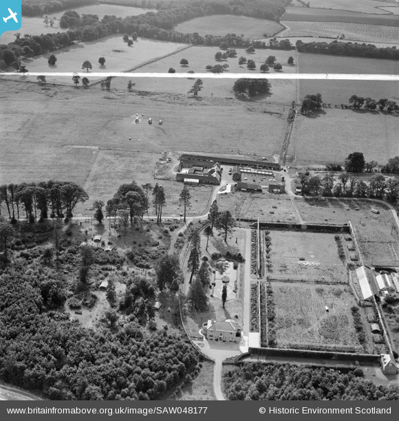
SAW048177 SCOTLAND (1953). Newbyth Mains and Walled Garden, Whitekirk. An oblique aerial photograph taken facing west. This image has been produced from a crop marked negative.
© Hawlfraint cyfranwyr OpenStreetMap a thrwyddedwyd gan yr OpenStreetMap Foundation. 2026. Trwyddedir y gartograffeg fel CC BY-SA.
Delweddau cyfagos (7)
SAW048175

SAW048177

SAW048179

SAW048181

SAW048183

SAW048174

SAW048176

Manylion
| Pennawd | [SAW048177] Newbyth Mains and Walled Garden, Whitekirk. An oblique aerial photograph taken facing west. This image has been produced from a crop marked negative. |
| Cyfeirnod | SAW048177 |
| Dyddiad | 1953 |
| Dolen | NRHE Collection item 1297847 |
| Enw lle | |
| Plwyf | WHITEKIRK AND TYNINGHAME |
| Ardal | EAST LOTHIAN |
| Gwlad | SCOTLAND |
| Dwyreiniad / Gogleddiad | 358550, 680330 |
| Hydred / Lledred | -2.6649185674865, 56.014149828439 |
| Cyfeirnod Grid Cenedlaethol | NT586803 |
Pinnau

Farm Buildings |
Wednesday 25th of September 2013 02:00:20 PM |
Cyfraniadau Grŵp

farm buildings |
Farm Buildings |
Wednesday 25th of September 2013 02:00:36 PM |
Newbyth Mains Farm was upgraded into 18 houses in 1990 forming Newbyth Steading and we were the first residents living in the SE corner house. Since the photograph was taken loads of trees have gone and other areas have been planted but otherwise things are remarkably the same. |
Peter n. Holmes |
Monday 2nd of July 2012 06:16:25 PM |