
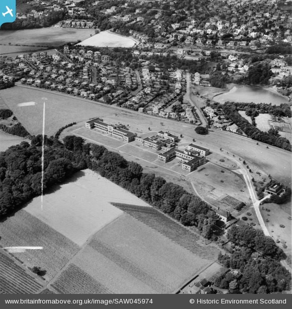
SAW045974 SCOTLAND (1952). Bearsden, general view, showing Canniesburn Auxiliary Hospital, Switchback Road and Colquhoun Park. An oblique aerial photograph taken facing north. This image has been produced from a crop marked negative.
© Hawlfraint cyfranwyr OpenStreetMap a thrwyddedwyd gan yr OpenStreetMap Foundation. 2026. Trwyddedir y gartograffeg fel CC BY-SA.
Delweddau cyfagos (7)
SAW045971

SAW045972

SAW045974

SAW045975

SAW045976

SAW045973

SAW045977

Manylion
| Pennawd | [SAW045974] Bearsden, general view, showing Canniesburn Auxiliary Hospital, Switchback Road and Colquhoun Park. An oblique aerial photograph taken facing north. This image has been produced from a crop marked negative. |
| Cyfeirnod | SAW045974 |
| Dyddiad | 1952 |
| Dolen | NRHE Collection item 1297678 |
| Enw lle | |
| Plwyf | NEW KILPATRICK (BEARSDEN AND MILNGAVIE) |
| Ardal | BEARSDEN AND MILNGAVIE |
| Gwlad | SCOTLAND |
| Dwyreiniad / Gogleddiad | 254416, 671048 |
| Hydred / Lledred | -4.3293660882011, 55.910507961852 |
| Cyfeirnod Grid Cenedlaethol | NS544710 |
Pinnau

emmgee |
Monday 21st of February 2022 11:48:37 PM |