
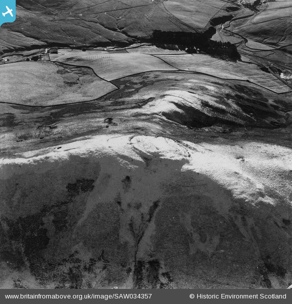
SAW034357 SCOTLAND (1950). Hindhope Hill Hillfort and Nether Hindhope, Cheviot Hills. An oblique aerial photograph taken facing south. This image has been produced from a print.
© Hawlfraint cyfranwyr OpenStreetMap a thrwyddedwyd gan yr OpenStreetMap Foundation. 2026. Trwyddedir y gartograffeg fel CC BY-SA.
Delweddau cyfagos (5)
SAW034352

SAW034353

SAW034354

SAW034355

SAW034357

Manylion
| Pennawd | [SAW034357] Hindhope Hill Hillfort and Nether Hindhope, Cheviot Hills. An oblique aerial photograph taken facing south. This image has been produced from a print. |
| Cyfeirnod | SAW034357 |
| Dyddiad | 1950 |
| Dolen | NRHE Collection item 1315217 |
| Enw lle | |
| Plwyf | OXNAM |
| Ardal | ROXBURGH |
| Gwlad | SCOTLAND |
| Dwyreiniad / Gogleddiad | 376818, 611271 |
| Hydred / Lledred | -2.3660359002752, 55.394817609652 |
| Cyfeirnod Grid Cenedlaethol | NT768113 |
Pinnau
Byddwch y cyntaf i ychwanegu sylw at y ddelwedd hon!