
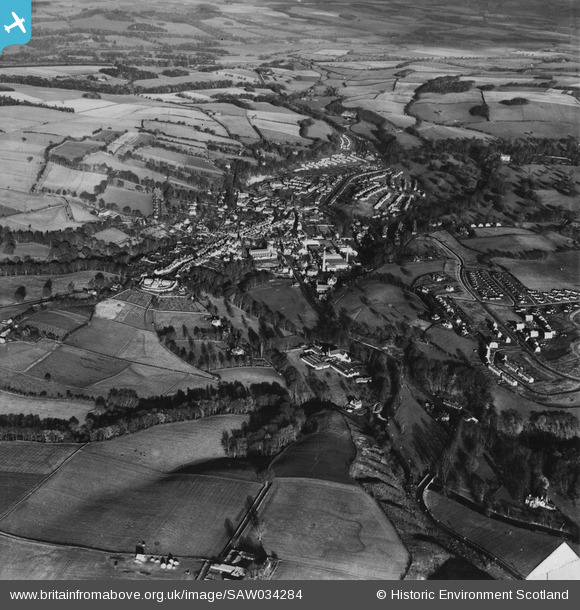
SAW034284 SCOTLAND (1950). Jedburgh, general view. An oblique aerial photograph taken facing north. This image has been produced from a damaged print.
© Hawlfraint cyfranwyr OpenStreetMap a thrwyddedwyd gan yr OpenStreetMap Foundation. 2026. Trwyddedir y gartograffeg fel CC BY-SA.
Delweddau cyfagos (8)
SAW034284

SAW034286

SAW034289

SAW034290

SAW034292

SAW034287

SAW034288

SAW034291

Manylion
| Pennawd | [SAW034284] Jedburgh, general view. An oblique aerial photograph taken facing north. This image has been produced from a damaged print. |
| Cyfeirnod | SAW034284 |
| Dyddiad | 1950 |
| Dolen | NRHE Collection item 1315191 |
| Enw lle | |
| Plwyf | JEDBURGH |
| Ardal | ROXBURGH |
| Gwlad | SCOTLAND |
| Dwyreiniad / Gogleddiad | 365056, 620285 |
| Hydred / Lledred | -2.5528767935443, 55.475122056694 |
| Cyfeirnod Grid Cenedlaethol | NT651203 |
Pinnau

Triggy |
Wednesday 5th of March 2014 02:20:38 PM |