
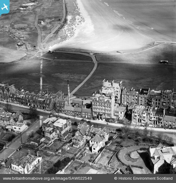
SAW022549 SCOTLAND (1949). St Andrews, general view, showing Rusack's Hotel, Pilmour Links and Old Course. An oblique aerial photograph taken facing north. This image has been produced from a crop marked negative.
© Hawlfraint cyfranwyr OpenStreetMap a thrwyddedwyd gan yr OpenStreetMap Foundation. 2026. Trwyddedir y gartograffeg fel CC BY-SA.
Delweddau cyfagos (10)
SAW022549

SAW022547

SAR018835

SAW022546

SAW022548

SAW022550

SAW005303

SAW005302

SAW022545

SPW040391

Manylion
| Pennawd | [SAW022549] St Andrews, general view, showing Rusack's Hotel, Pilmour Links and Old Course. An oblique aerial photograph taken facing north. This image has been produced from a crop marked negative. |
| Cyfeirnod | SAW022549 |
| Dyddiad | 1949 |
| Dolen | NRHE Collection item 1268982 |
| Enw lle | |
| Plwyf | ST ANDREWS AND ST LEONARDS |
| Ardal | NORTH EAST FIFE |
| Gwlad | SCOTLAND |
| Dwyreiniad / Gogleddiad | 350350, 717100 |
| Hydred / Lledred | -2.8033154460186, 56.343734843992 |
| Cyfeirnod Grid Cenedlaethol | NO504171 |
Pinnau
Byddwch y cyntaf i ychwanegu sylw at y ddelwedd hon!