
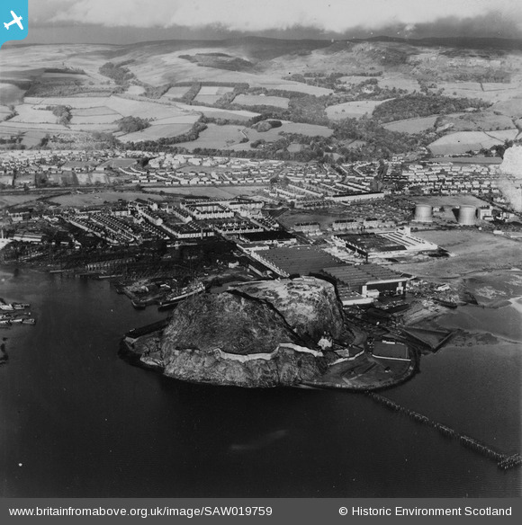
SAW019759 SCOTLAND (1948). Dumbarton, general view, showing Dumbarton Rock and Glasgow Road. An oblique aerial photograph taken facing north-east. This image has been produced from a print.
© Hawlfraint cyfranwyr OpenStreetMap a thrwyddedwyd gan yr OpenStreetMap Foundation. 2026. Trwyddedir y gartograffeg fel CC BY-SA.
Delweddau cyfagos (3)
SAW019759

SAW019760

SAW019758

Manylion
| Pennawd | [SAW019759] Dumbarton, general view, showing Dumbarton Rock and Glasgow Road. An oblique aerial photograph taken facing north-east. This image has been produced from a print. |
| Cyfeirnod | SAW019759 |
| Dyddiad | 1948 |
| Dolen | NRHE Collection item 1315070 |
| Enw lle | |
| Plwyf | DUMBARTON |
| Ardal | DUMBARTON |
| Gwlad | SCOTLAND |
| Dwyreiniad / Gogleddiad | 240370, 674880 |
| Hydred / Lledred | -4.5561286798769, 55.940454633562 |
| Cyfeirnod Grid Cenedlaethol | NS404749 |
Pinnau
Byddwch y cyntaf i ychwanegu sylw at y ddelwedd hon!