
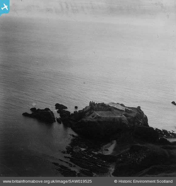
SAW019525 SCOTLAND (1948). Dunnottar Castle. An oblique aerial photograph taken facing south-east. This image has been produced from a print.
© Hawlfraint cyfranwyr OpenStreetMap a thrwyddedwyd gan yr OpenStreetMap Foundation. 2026. Trwyddedir y gartograffeg fel CC BY-SA.
Delweddau cyfagos (5)
SAW019525

SAW019524

SAW019645

SPW040489

SAW019523

Manylion
| Pennawd | [SAW019525] Dunnottar Castle. An oblique aerial photograph taken facing south-east. This image has been produced from a print. |
| Cyfeirnod | SAW019525 |
| Dyddiad | 1948 |
| Dolen | NRHE Collection item 1314913 |
| Enw lle | |
| Plwyf | DUNNOTTAR |
| Ardal | KINCARDINE AND DEESIDE |
| Gwlad | SCOTLAND |
| Dwyreiniad / Gogleddiad | 388163, 783817 |
| Hydred / Lledred | -2.1945899113787, 56.945626149784 |
| Cyfeirnod Grid Cenedlaethol | NO882838 |
Pinnau
Byddwch y cyntaf i ychwanegu sylw at y ddelwedd hon!