
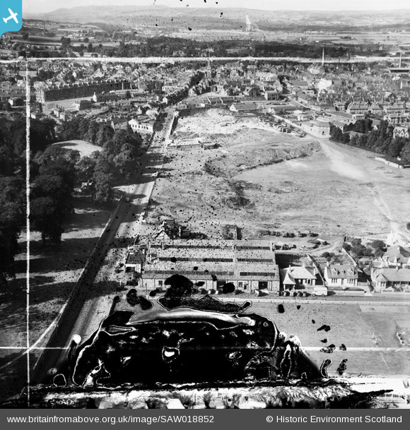
SAW018852 SCOTLAND (1948). Falkirk, general view, showing Millars Garage, Callendar Road and Bellsmeadow. An oblique aerial photograph taken facing west. This image has been produced from a damaged and crop marked negative.
© Hawlfraint cyfranwyr OpenStreetMap a thrwyddedwyd gan yr OpenStreetMap Foundation. 2026. Trwyddedir y gartograffeg fel CC BY-SA.
Delweddau cyfagos (8)
SAW018851

SAW018852

SAW038976

SAW038977

SAW038978

SAW038979

SAW038980

SAW038981

Manylion
| Pennawd | [SAW018852] Falkirk, general view, showing Millars Garage, Callendar Road and Bellsmeadow. An oblique aerial photograph taken facing west. This image has been produced from a damaged and crop marked negative. |
| Cyfeirnod | SAW018852 |
| Dyddiad | 1948 |
| Dolen | NRHE Collection item 1269131 |
| Enw lle | |
| Plwyf | FALKIRK |
| Ardal | FALKIRK |
| Gwlad | SCOTLAND |
| Dwyreiniad / Gogleddiad | 289531, 679795 |
| Hydred / Lledred | -3.7714546758045, 55.998411368488 |
| Cyfeirnod Grid Cenedlaethol | NS895798 |
Pinnau

gBr |
Monday 25th of January 2016 06:44:41 PM | |
|
r1d1 |
Thursday 20th of March 2014 11:42:10 AM | |
|
r1d1 |
Thursday 20th of March 2014 11:40:57 AM | |
|
Speed |
Sunday 9th of September 2012 08:43:33 PM | |
|
Domino |
Sunday 8th of July 2012 03:17:32 PM | |
|
Domino |
Sunday 8th of July 2012 10:19:01 AM | |
|
Domino |
Sunday 8th of July 2012 10:18:12 AM | |
|
Domino |
Sunday 8th of July 2012 10:17:37 AM | |
|
Cailean |
Tuesday 26th of June 2012 02:21:00 PM |