
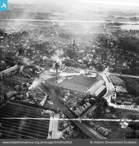
SAW018831 SCOTLAND (1948). Dunfermline, general view, showing Winterthur Silks Ltd. Canmore Works, Bruce Street and Carnegie Drive. An oblique aerial photograph taken facing south. This image has been produced from a crop marked negative.
© Hawlfraint cyfranwyr OpenStreetMap a thrwyddedwyd gan yr OpenStreetMap Foundation. 2026. Trwyddedir y gartograffeg fel CC BY-SA.
Delweddau cyfagos (12)
SAW018831

SAW018827

SAW018830

SAW018832

SAW018829

SAW018833

SAW018828

SAW018834

SAW018836

SAW018835

SAW018837

SPW040404

Manylion
| Pennawd | [SAW018831] Dunfermline, general view, showing Winterthur Silks Ltd. Canmore Works, Bruce Street and Carnegie Drive. An oblique aerial photograph taken facing south. This image has been produced from a crop marked negative. |
| Cyfeirnod | SAW018831 |
| Dyddiad | 1948 |
| Dolen | NRHE Collection item 1269126 |
| Enw lle | |
| Plwyf | DUNFERMLINE |
| Ardal | DUNFERMLINE |
| Gwlad | SCOTLAND |
| Dwyreiniad / Gogleddiad | 309062, 687665 |
| Hydred / Lledred | -3.4610556148512, 56.073206215418 |
| Cyfeirnod Grid Cenedlaethol | NT091877 |
Pinnau
Byddwch y cyntaf i ychwanegu sylw at y ddelwedd hon!