
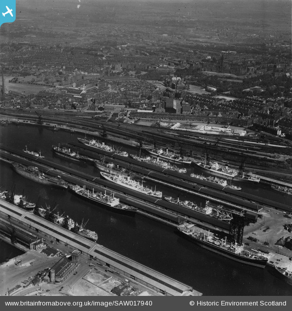
SAW017940 SCOTLAND (1948). Queen's Dock, Glasgow. An oblique aerial photograph taken facing north. This image has been produced from a print.
© Hawlfraint cyfranwyr OpenStreetMap a thrwyddedwyd gan yr OpenStreetMap Foundation. 2026. Trwyddedir y gartograffeg fel CC BY-SA.
Delweddau cyfagos (16)
SAW017940

SAW017941

SPW045891

SAR008788

SAR008790

SAR014705

SAR014707

SAR014709

SAR014713

SAR014774

SAR014826

SAR014832

SAR015079

SPW020708

SAW017939

SPW045884

Manylion
| Pennawd | [SAW017940] Queen's Dock, Glasgow. An oblique aerial photograph taken facing north. This image has been produced from a print. |
| Cyfeirnod | SAW017940 |
| Dyddiad | 1948 |
| Dolen | NRHE Collection item 1314858 |
| Enw lle | |
| Plwyf | GLASGOW (CITY OF GLASGOW) |
| Ardal | CITY OF GLASGOW |
| Gwlad | SCOTLAND |
| Dwyreiniad / Gogleddiad | 256750, 665580 |
| Hydred / Lledred | -4.2891626014158, 55.862112575573 |
| Cyfeirnod Grid Cenedlaethol | NS568656 |
Pinnau
Byddwch y cyntaf i ychwanegu sylw at y ddelwedd hon!