
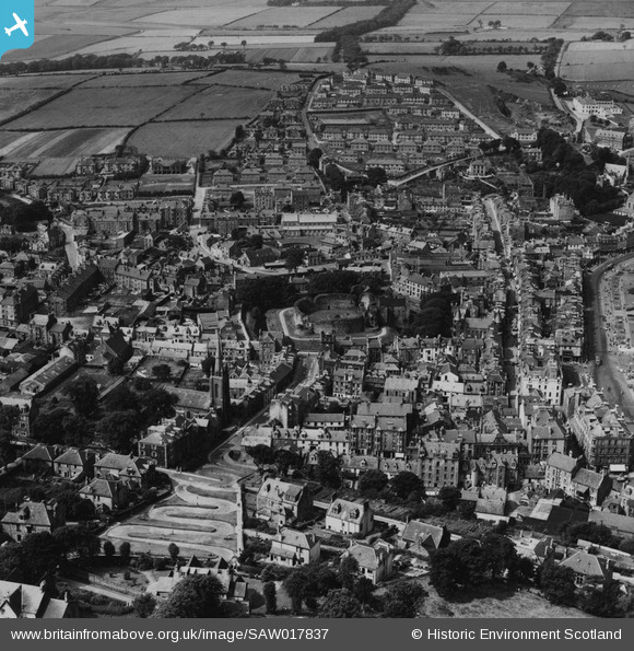
SAW017837 SCOTLAND (1948). Rothesay, general view, showing Rothesay Castle and Serpentine Road, Isle of Bute. An oblique aerial photograph taken facing west. This image has been produced from a print.
© Hawlfraint cyfranwyr OpenStreetMap a thrwyddedwyd gan yr OpenStreetMap Foundation. 2026. Trwyddedir y gartograffeg fel CC BY-SA.
Delweddau cyfagos (10)
SAW017837

SPW019571

SAW017839

SPW019570

SAW017838

SAR016596

SAR016597

SAR016598

SAW017841

SPW019575

Manylion
| Pennawd | [SAW017837] Rothesay, general view, showing Rothesay Castle and Serpentine Road, Isle of Bute. An oblique aerial photograph taken facing west. This image has been produced from a print. |
| Cyfeirnod | SAW017837 |
| Dyddiad | 1948 |
| Dolen | NRHE Collection item 1314785 |
| Enw lle | |
| Plwyf | ROTHESAY |
| Ardal | ARGYLL AND BUTE |
| Gwlad | SCOTLAND |
| Dwyreiniad / Gogleddiad | 208781, 664585 |
| Hydred / Lledred | -5.0539452305199, 55.836553987835 |
| Cyfeirnod Grid Cenedlaethol | NS088646 |
