
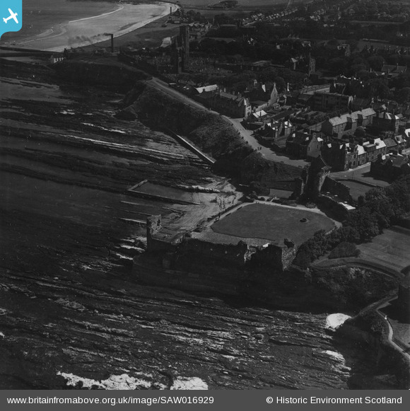
SAW016929 SCOTLAND (1948). St Andrews, general view, showing St Andrews Castle and Cathedral. An oblique aerial photograph taken facing south. This image has been produced from a print.
© Hawlfraint cyfranwyr OpenStreetMap a thrwyddedwyd gan yr OpenStreetMap Foundation. 2026. Trwyddedir y gartograffeg fel CC BY-SA.
Delweddau cyfagos (11)
SAW016929

SAW016932

SPW040384

SPW020136

SAW016930

SAW016931

SAW024475

SPW040389

SAW005305

SPW040385

SAW024474

Manylion
| Pennawd | [SAW016929] St Andrews, general view, showing St Andrews Castle and Cathedral. An oblique aerial photograph taken facing south. This image has been produced from a print. |
| Cyfeirnod | SAW016929 |
| Dyddiad | 1948 |
| Dolen | NRHE Collection item 1314768 |
| Enw lle | |
| Plwyf | ST ANDREWS AND ST LEONARDS |
| Ardal | NORTH EAST FIFE |
| Gwlad | SCOTLAND |
| Dwyreiniad / Gogleddiad | 351310, 716870 |
| Hydred / Lledred | -2.7877421519272, 56.341768122742 |
| Cyfeirnod Grid Cenedlaethol | NO513169 |
Pinnau
Byddwch y cyntaf i ychwanegu sylw at y ddelwedd hon!