
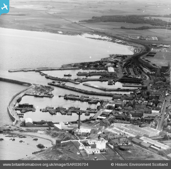
SAR036704 SCOTLAND (1959). General View Fraserburgh, Aberdeenshire, Scotland. An oblique aerial photograph taken facing South.
© Hawlfraint cyfranwyr OpenStreetMap a thrwyddedwyd gan yr OpenStreetMap Foundation. 2026. Trwyddedir y gartograffeg fel CC BY-SA.
Delweddau cyfagos (8)
SAR033563

SAR033564

SAR033565

SAR033566

SAR036704

SAR036705

SAR036707

SAR036708

Manylion
| Pennawd | [SAR036704] General View Fraserburgh, Aberdeenshire, Scotland. An oblique aerial photograph taken facing South. |
| Cyfeirnod | SAR036704 |
| Dyddiad | 1959 |
| Dolen | NRHE Collection item 1438664 |
| Enw lle | |
| Plwyf | FRASERBURGH |
| Ardal | BANFF AND BUCHAN |
| Gwlad | SCOTLAND |
| Dwyreiniad / Gogleddiad | 399000, 867000 |
| Hydred / Lledred | -2.0167761824613, 57.693079010528 |
| Cyfeirnod Grid Cenedlaethol | NJ990670 |
Pinnau

redmist |
Saturday 30th of January 2021 01:32:39 PM |