
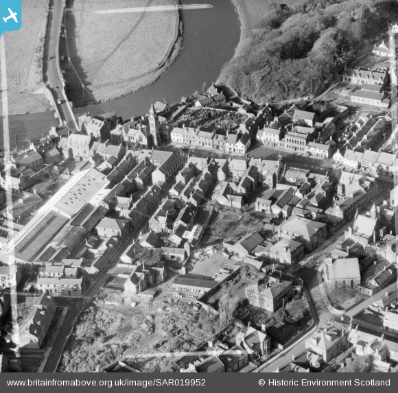
SAR019952 SCOTLAND (1953). General View Annan, Dumfries-Shire, Scotland. An oblique aerial photograph taken facing North/West. This image was marked by AeroPictorial Ltd for photo editing.
© Hawlfraint cyfranwyr OpenStreetMap a thrwyddedwyd gan yr OpenStreetMap Foundation. 2026. Trwyddedir y gartograffeg fel CC BY-SA.
Delweddau cyfagos (13)
SAR019951

SAR019952

SPW029232

SPW040215

SPW040217

SPW029236

SPW029235

SPW029233

SPW029234

SPW029229

SPW040216

SAW043379

SAW043380

Manylion
| Pennawd | [SAR019952] General View Annan, Dumfries-Shire, Scotland. An oblique aerial photograph taken facing North/West. This image was marked by AeroPictorial Ltd for photo editing. |
| Cyfeirnod | SAR019952 |
| Dyddiad | 1953 |
| Dolen | NRHE Collection item 1438211 |
| Enw lle | |
| Plwyf | ANNAN |
| Ardal | ANNANDALE AND ESKDALE |
| Gwlad | SCOTLAND |
| Dwyreiniad / Gogleddiad | 319500, 566500 |
| Hydred / Lledred | -3.2581651998492, 54.986505184482 |
| Cyfeirnod Grid Cenedlaethol | NY195665 |
Pinnau
Byddwch y cyntaf i ychwanegu sylw at y ddelwedd hon!