
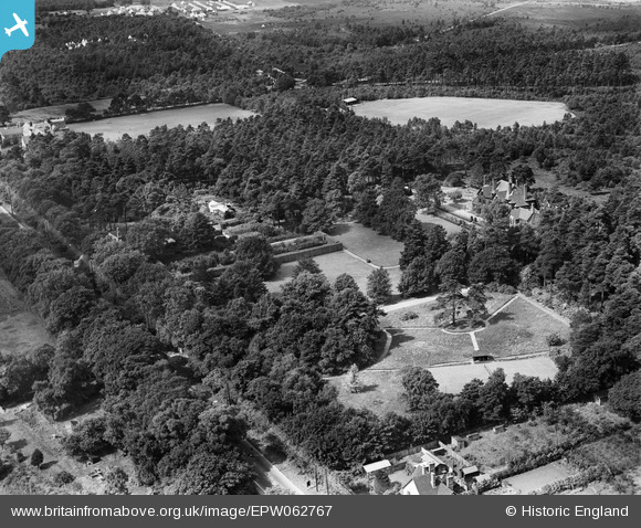
EPW062767 ENGLAND (1939). The Grove and environs, Camberley, 1939
© Hawlfraint cyfranwyr OpenStreetMap a thrwyddedwyd gan yr OpenStreetMap Foundation. 2026. Trwyddedir y gartograffeg fel CC BY-SA.
Delweddau cyfagos (9)
EPW062767

EPW062769

EPW062765

EPW062768

EPW062762

EPW062764

EPW062766

EPW062770

EPW062763

Manylion
| Pennawd | [EPW062767] The Grove and environs, Camberley, 1939 |
| Cyfeirnod | EPW062767 |
| Dyddiad | 23-August-1939 |
| Dolen | |
| Enw lle | CAMBERLEY |
| Plwyf | |
| Ardal | |
| Gwlad | ENGLAND |
| Dwyreiniad / Gogleddiad | 489465, 161857 |
| Hydred / Lledred | -0.7152306446354, 51.348241242553 |
| Cyfeirnod Grid Cenedlaethol | SU895619 |
Pinnau

markhortonphotography |
Friday 21st of February 2014 10:40:35 PM | |
|
markhortonphotography |
Monday 27th of January 2014 07:05:58 PM | |
|
markhortonphotography |
Monday 27th of January 2014 07:02:30 PM | |
|
markhortonphotography |
Monday 27th of January 2014 07:01:29 PM | |
|
markhortonphotography |
Monday 27th of January 2014 07:01:12 PM |
Cyfraniadau Grŵp
This is now the site of Collingwood College The main building is near the 6th Form Centre car park and F block |
Media Technician |
Sunday 26th of January 2014 07:42:19 AM |