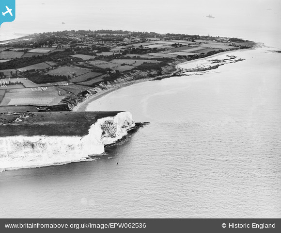
EPW062536 ENGLAND (1939). Culver Cliff and Whitecliff Bay, Bembridge, from the south-west, 1939
© Hawlfraint cyfranwyr OpenStreetMap a thrwyddedwyd gan yr OpenStreetMap Foundation. 2026. Trwyddedir y gartograffeg fel CC BY-SA.
Manylion
| Pennawd | [EPW062536] Culver Cliff and Whitecliff Bay, Bembridge, from the south-west, 1939 |
| Cyfeirnod | EPW062536 |
| Dyddiad | 11-August-1939 |
| Dolen | |
| Enw lle | BEMBRIDGE |
| Plwyf | BEMBRIDGE |
| Ardal | |
| Gwlad | ENGLAND |
| Dwyreiniad / Gogleddiad | 463996, 85289 |
| Hydred / Lledred | -1.0944271006903, 50.663172160242 |
| Cyfeirnod Grid Cenedlaethol | SZ640853 |
Pinnau

Matt Aldred edob.mattaldred.com |
Thursday 27th of January 2022 04:06:00 PM | |

Matt Aldred edob.mattaldred.com |
Thursday 27th of January 2022 04:05:30 PM | |

Guy |
Tuesday 1st of June 2021 10:24:44 AM | |

Biggles1951 |
Thursday 12th of December 2013 05:28:36 PM |


![[EPW062536] Culver Cliff and Whitecliff Bay, Bembridge, from the south-west, 1939](http://britainfromabove.org.uk/sites/all/libraries/aerofilms-images/public/100x100/EPW/062/EPW062536.jpg)
![[EPW039639] Culver Down, Culver Cliff, 1932](http://britainfromabove.org.uk/sites/all/libraries/aerofilms-images/public/100x100/EPW/039/EPW039639.jpg)