
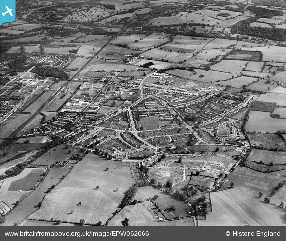
EPW062066 ENGLAND (1939). Peartree and Woodhall, Welwyn Garden City, from the south, 1939
© Hawlfraint cyfranwyr OpenStreetMap a thrwyddedwyd gan yr OpenStreetMap Foundation. 2026. Trwyddedir y gartograffeg fel CC BY-SA.
Delweddau cyfagos (6)
EPW062066

EPW062065

EPW062074

EPW062067

EAW041975

EPW062047

Manylion
| Pennawd | [EPW062066] Peartree and Woodhall, Welwyn Garden City, from the south, 1939 |
| Cyfeirnod | EPW062066 |
| Dyddiad | 28-June-1939 |
| Dolen | |
| Enw lle | WELWYN GARDEN CITY |
| Plwyf | |
| Ardal | |
| Gwlad | ENGLAND |
| Dwyreiniad / Gogleddiad | 524403, 211729 |
| Hydred / Lledred | -0.19606847162464, 51.789915426643 |
| Cyfeirnod Grid Cenedlaethol | TL244117 |
Pinnau

SueB |
Sunday 24th of April 2016 11:53:44 PM | |
|
SueB |
Sunday 10th of April 2016 11:17:49 PM | |
|
SueB |
Sunday 10th of April 2016 11:14:43 PM |