
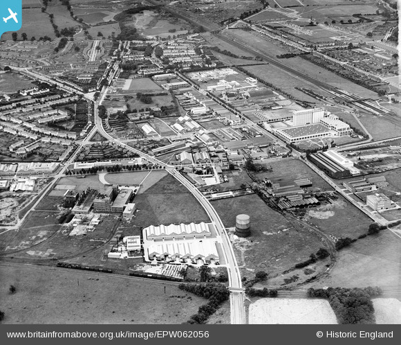
EPW062056 ENGLAND (1939). Peartree Lane and environs, Welwyn Garden City, from the north-east, 1939
© Hawlfraint cyfranwyr OpenStreetMap a thrwyddedwyd gan yr OpenStreetMap Foundation. 2026. Trwyddedir y gartograffeg fel CC BY-SA.
Delweddau cyfagos (18)
EPW062056

EPW054503

EAW016528
, Welwyn Garden City, 1948. This image has been produced from a damaged negative.")
EAW016532
, Welwyn Garden City, 1948. This image has been produced from a damaged negative.")
EAW016526

EAW016535
, Welwyn Garden City, 1948. This image has been produced from a damaged negative.")
EAW016527
, Welwyn Garden City, 1948. This image has been produced from a damaged negative.")
EAW052994

EAW016529
, Welwyn Garden City, 1948. This image has been produced from a damaged negative.")
EAW016530
, Welwyn Garden City, 1948. This image has been produced from a damaged negative.")
EAW016536
, Welwyn Garden City, 1948. This image has been produced from a damaged negative.")
EAW016523

EAW053106

EPW054492

EPW047351

EAW016525

EAW016531
, Welwyn Garden City, 1948. This image has been produced from a damaged negative.")
EAW016533

Manylion
| Pennawd | [EPW062056] Peartree Lane and environs, Welwyn Garden City, from the north-east, 1939 |
| Cyfeirnod | EPW062056 |
| Dyddiad | 28-June-1939 |
| Dolen | |
| Enw lle | WELWYN GARDEN CITY |
| Plwyf | |
| Ardal | |
| Gwlad | ENGLAND |
| Dwyreiniad / Gogleddiad | 524630, 213174 |
| Hydred / Lledred | -0.19225917443137, 51.802851936207 |
| Cyfeirnod Grid Cenedlaethol | TL246132 |
Pinnau

Matt Aldred edob.mattaldred.com |
Thursday 7th of March 2024 11:05:18 AM | |
|
Matt Aldred edob.mattaldred.com |
Thursday 7th of March 2024 11:04:51 AM | |
|
Matt Aldred edob.mattaldred.com |
Thursday 7th of March 2024 11:04:20 AM | |
|
Matt Aldred edob.mattaldred.com |
Thursday 7th of March 2024 11:03:21 AM |