
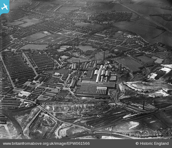
EPW061566 ENGLAND (1939). The Gerard's Bridge Plate Glass Works, Victoria Park and the surrounding residential area, St Helens, 1939
© Hawlfraint cyfranwyr OpenStreetMap a thrwyddedwyd gan yr OpenStreetMap Foundation. 2026. Trwyddedir y gartograffeg fel CC BY-SA.
Delweddau cyfagos (19)
EPW061566

EPW061569

EPW061570

EAW013770

EPW009312

EAW013757

EAW012390

EPW061568

EPW009316

EAW013754

EPW061567

EPW009318

EPW061563

EPW009311

EPW009317

EPW061564

EPW061571

EAW012393

EAW012387

Manylion
| Pennawd | [EPW061566] The Gerard's Bridge Plate Glass Works, Victoria Park and the surrounding residential area, St Helens, 1939 |
| Cyfeirnod | EPW061566 |
| Dyddiad | 4-June-1939 |
| Dolen | |
| Enw lle | ST HELENS |
| Plwyf | |
| Ardal | |
| Gwlad | ENGLAND |
| Dwyreiniad / Gogleddiad | 350995, 396468 |
| Hydred / Lledred | -2.7382025594625, 53.462420866437 |
| Cyfeirnod Grid Cenedlaethol | SJ510965 |
Pinnau

manitas |
Thursday 3rd of October 2019 07:12:02 PM | |
|
manitas |
Thursday 3rd of October 2019 07:11:29 PM | |
|
manitas |
Thursday 3rd of October 2019 07:10:21 PM | |
|
manitas |
Thursday 3rd of October 2019 07:08:45 PM | |
|
vswift |
Monday 20th of February 2017 07:22:43 PM | |
|
dotcomdan |
Sunday 19th of July 2015 12:02:43 AM | |
|
pauloyick |
Tuesday 7th of January 2014 07:31:50 PM |