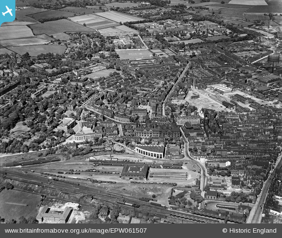
EPW061507 ENGLAND (1939). Northgate and environs, Wakefield, from the south-west, 1939
© Hawlfraint cyfranwyr OpenStreetMap a thrwyddedwyd gan yr OpenStreetMap Foundation. 2026. Trwyddedir y gartograffeg fel CC BY-SA.
Manylion
| Pennawd | [EPW061507] Northgate and environs, Wakefield, from the south-west, 1939 |
| Cyfeirnod | EPW061507 |
| Dyddiad | 2-June-1939 |
| Dolen | |
| Enw lle | WAKEFIELD |
| Plwyf | |
| Ardal | |
| Gwlad | ENGLAND |
| Dwyreiniad / Gogleddiad | 432809, 420924 |
| Hydred / Lledred | -1.5031883642872, 53.683514320411 |
| Cyfeirnod Grid Cenedlaethol | SE328209 |
Pinnau

tim birch |
Sunday 28th of November 2021 08:21:31 PM |


![[EPW061507] Northgate and environs, Wakefield, from the south-west, 1939](http://britainfromabove.org.uk/sites/all/libraries/aerofilms-images/public/100x100/EPW/061/EPW061507.jpg)
![[EAW025171] County Hall, the Town Hall and streets around Westgate, Wakefield, from the south-east, 1949](http://britainfromabove.org.uk/sites/all/libraries/aerofilms-images/public/100x100/EAW/025/EAW025171.jpg)