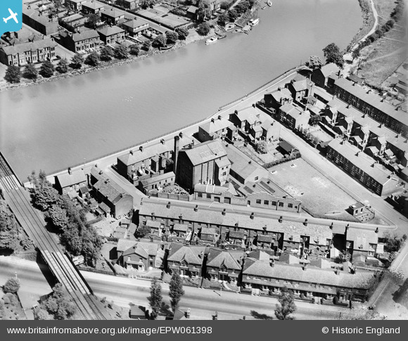
EPW061398 ENGLAND (1939). The Riverside Works on Gaskell Road, Lower Penwortham, 1939
    © Hawlfraint cyfranwyr OpenStreetMap a thrwyddedwyd gan yr OpenStreetMap Foundation. 2025. Trwyddedir y gartograffeg fel CC BY-SA.
  
Manylion
| Pennawd | [EPW061398] The Riverside Works on Gaskell Road, Lower Penwortham, 1939 | 
| Cyfeirnod | EPW061398 | 
| Dyddiad | 2-June-1939 | 
| Dolen | |
| Enw lle | LOWER PENWORTHAM | 
| Plwyf | PENWORTHAM | 
| Ardal | |
| Gwlad | ENGLAND | 
| Dwyreiniad / Gogleddiad | 353070, 428152 | 
| Hydred / Lledred | -2.711719960711, 53.747405116632 | 
| Cyfeirnod Grid Cenedlaethol | SD531282 | 
Pinnau
Byddwch y cyntaf i ychwanegu sylw at y ddelwedd hon!
 
             
  ![[EPW061398] The Riverside Works on Gaskell Road, Lower Penwortham, 1939](http://britainfromabove.org.uk/sites/all/libraries/aerofilms-images/public/100x100/EPW/061/EPW061398.jpg) 
  
                                          ![[EPW061396] Gaskell Road, Penwortham Bridge, the railway viaduct and environs, Lower Penwortham, 1939](http://britainfromabove.org.uk/sites/all/libraries/aerofilms-images/public/100x100/EPW/061/EPW061396.jpg) 
 ![[EPW061399] The Riverside Works on Gaskell Road, Lower Penwortham, 1939](http://britainfromabove.org.uk/sites/all/libraries/aerofilms-images/public/100x100/EPW/061/EPW061399.jpg) 
 ![[EPW061397] The Riverside Works on Gaskell Road, Lower Penwortham, 1939](http://britainfromabove.org.uk/sites/all/libraries/aerofilms-images/public/100x100/EPW/061/EPW061397.jpg)