
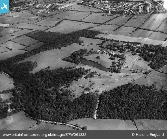
EPW061332 ENGLAND (1939). Trent Park, Enfield, 1939
© Hawlfraint cyfranwyr OpenStreetMap a thrwyddedwyd gan yr OpenStreetMap Foundation. 2026. Trwyddedir y gartograffeg fel CC BY-SA.
Delweddau cyfagos (3)
EPW061332

EPW059366

EAW020761

Manylion
| Pennawd | [EPW061332] Trent Park, Enfield, 1939 |
| Cyfeirnod | EPW061332 |
| Dyddiad | 2-June-1939 |
| Dolen | |
| Enw lle | ENFIELD |
| Plwyf | |
| Ardal | |
| Gwlad | ENGLAND |
| Dwyreiniad / Gogleddiad | 529121, 197604 |
| Hydred / Lledred | -0.13293134955694, 51.661899600047 |
| Cyfeirnod Grid Cenedlaethol | TQ291976 |
Pinnau

Lee P |
Monday 7th of October 2019 05:34:47 PM | |
|
David |
Sunday 12th of January 2014 06:15:03 PM | |
|
David |
Sunday 12th of January 2014 06:05:29 PM | |
|
Macmartyn |
Monday 4th of November 2013 02:27:15 PM | |
|
Macmartyn |
Monday 4th of November 2013 02:20:53 PM | |
|
Macmartyn |
Monday 4th of November 2013 02:13:13 PM | |
|
Macmartyn |
Monday 4th of November 2013 02:09:51 PM | |
|
Macmartyn |
Monday 4th of November 2013 02:00:47 PM | |
|
Macmartyn |
Monday 4th of November 2013 01:56:49 PM | |
|
Macmartyn |
Monday 4th of November 2013 01:52:01 PM |