
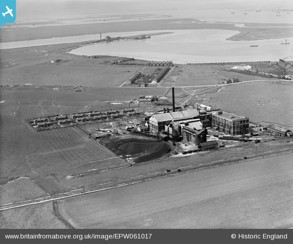
EPW061017 ENGLAND (1939). The Pilkington Brothers Ltd Glass Works and The Swale, Rushenden, from the east, 1939
© Hawlfraint cyfranwyr OpenStreetMap a thrwyddedwyd gan yr OpenStreetMap Foundation. 2026. Trwyddedir y gartograffeg fel CC BY-SA.
Delweddau cyfagos (11)
EPW061017

EPW061020

EPW061023

EPW061025

EPW061021

EPW061019

EPW061028

EPW061018

EPW061016

EPW061024

EPW061022

Manylion
| Pennawd | [EPW061017] The Pilkington Brothers Ltd Glass Works and The Swale, Rushenden, from the east, 1939 |
| Cyfeirnod | EPW061017 |
| Dyddiad | 20-May-1939 |
| Dolen | |
| Enw lle | RUSHENDEN |
| Plwyf | QUEENBOROUGH |
| Ardal | |
| Gwlad | ENGLAND |
| Dwyreiniad / Gogleddiad | 591415, 171280 |
| Hydred / Lledred | 0.75257755328033, 51.407695563513 |
| Cyfeirnod Grid Cenedlaethol | TQ914713 |
Pinnau
Byddwch y cyntaf i ychwanegu sylw at y ddelwedd hon!